
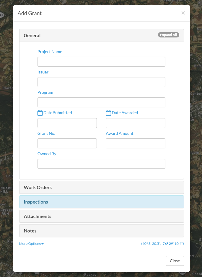
Thanks to the very good suggestion from our friends at West Hempfield, you can now track your "grant" activity directly in CSDatum! Track basic information, draw the project area on your map - and most important, upload all of those attachments and invite collaborators to your CSDatum account. Keep everything in one place!
Very quickly - here's how to start adding them.
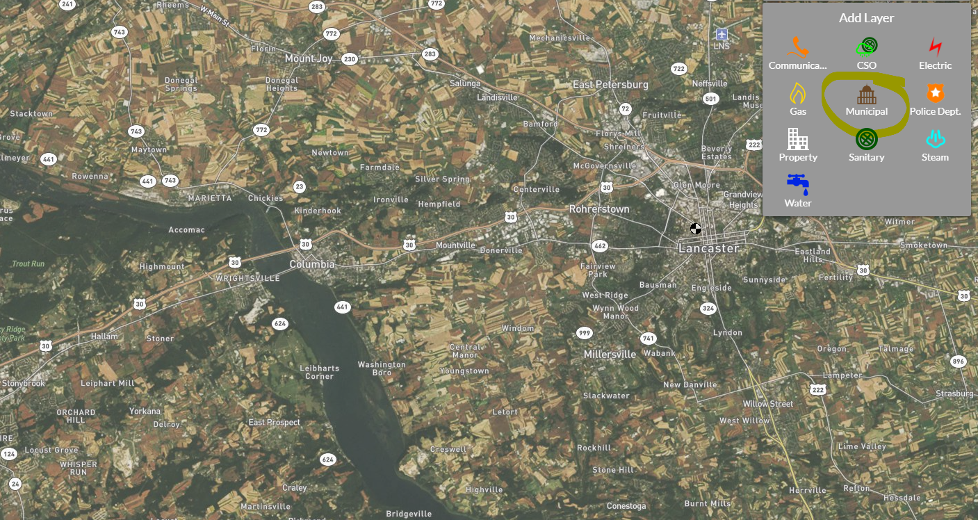
1. Look for the "Add Layer" icon in your map legend.
2. Click on the Municipal Icon. Please note, this is also how to add other new content that is available within our layer system.
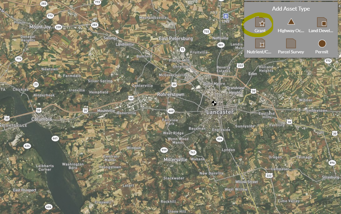
3. Click on the Grant icon.
4. Choose your preference of a Point or a Polygon - and then click on the map at your desired location.
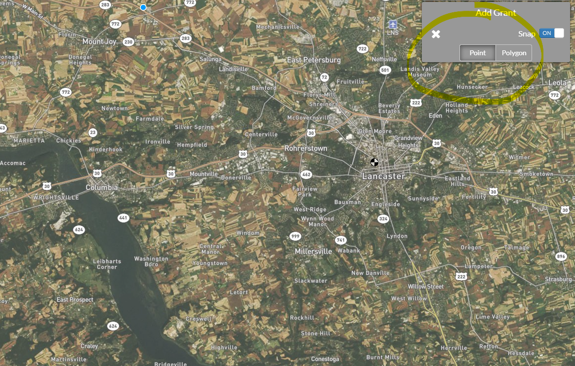
5. Enter a project name, issuer (like DEP), program (like Growing Greener), etc - hit save, and you're done!
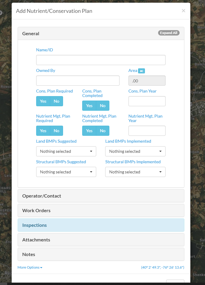
And you might have noticed from Step #3, but we also made a "Nutrient/Conservation Plan" asset available for our rural clients to help track farms within their municipality. We built this with the help of Salisbury Township in Lancaster County many months ago - but we wanted to open it up for everyone.
Here's a screenshot of the information you can manage - and just like with Grants, it's a point/polygon feature under the Municipal layer.
That's it for now - and enjoy these two new features!