
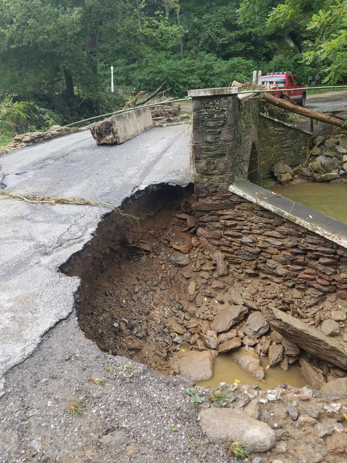
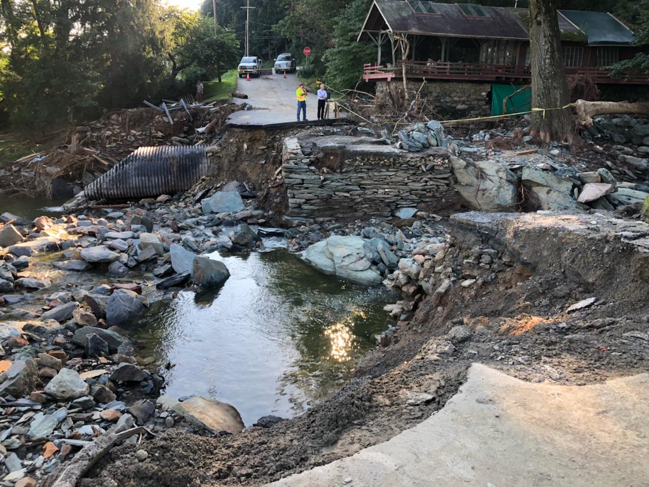
For many CSDatum subscribers, August was a brutal month. Heavy rains (repeatedly) worked their way across South Central PA and damaged our roads and bridges. The scenes below are all too familiar - both taken by C.S. Davidson engineers in York County after the Labor Day storm (10-12 inches in 1.5 hours!)
Many of you serve our community as first responders, so thank you for helping in our time of need! You're also responsible for documenting the infrastructure conditions during the storm - and repairing the roads and bridges once the waters recede. CSDatum can't stop the rain or rebuild the roads - but it can help you with tracking your data!
Using GIS - we analyzed every potential stream and local road intersection. These 'crossing' points have been added to your account under the 'Notes' Layer. Click on the 'Stream Crossings' note to toggle them on or off. You should see a series of blue dots labeled with the letter X.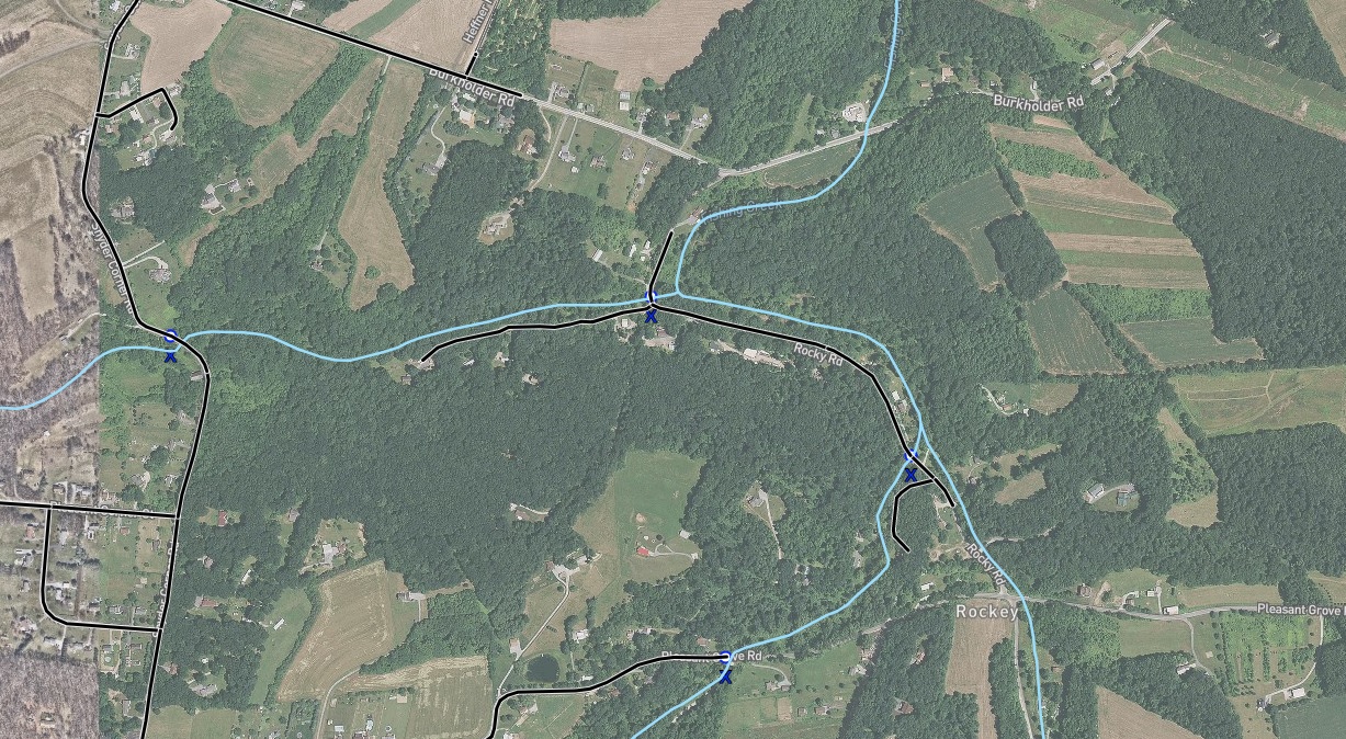
Click on any one of these points - and you'll see a pop-up with the road and stream name.
Please note, we haven't visited these locations or analyzed the size of each upstream watershed. This simply represents the intersection of a PA DEP Chapter 93 Stream and a PennDOT Local Road. It could be a small pipe, a 40' span bridge or a swale washing over a dirt road. We're just trying to help you find them - which can be overwhelming in a flood event.
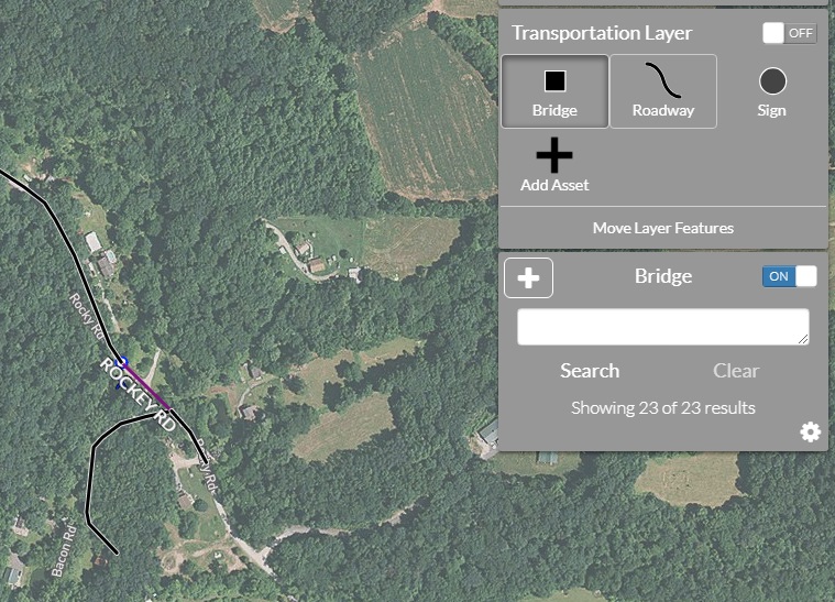
If the blue dot is an actual bridge (typically we define a bridge as any structure larger than a 48" diameter pipe - PennDOT says 8' ); we suggest adding it as a bridge asset under the Transportation Layer. This will allow you to store notes, conditions and access the flood monitoring log.
You likely know where your large bridges or troublesome locations are - but this might help you think about your entire drainage inventory. It's also a good time to consider having the system inspected by a professional engineer or capable municipal staff. The smaller bridges are often in the worst shape - as they're not regulated by PennDOT and are easier to miss.
This pre-built form is applicable for all bridges - but it's essential for PennDOT Scour Critical structures. If you own a Scour Critical A, B or C bridge - this can save you a ton of time, paperwork, and headache.
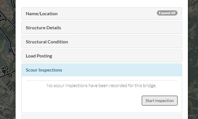
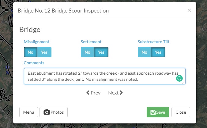
It works just like our other inspection forms and should be very easy to use. Just answer the questions and jot down your observations.
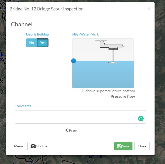
Remember to note the high-water mark and any debris build-up....these are critical bits of information for your bridge engineer or PennDOT. If the bridge was overtopped, it went under pressure flow...which is a fancy way to say it was hit really, really hard with flood water velocities.
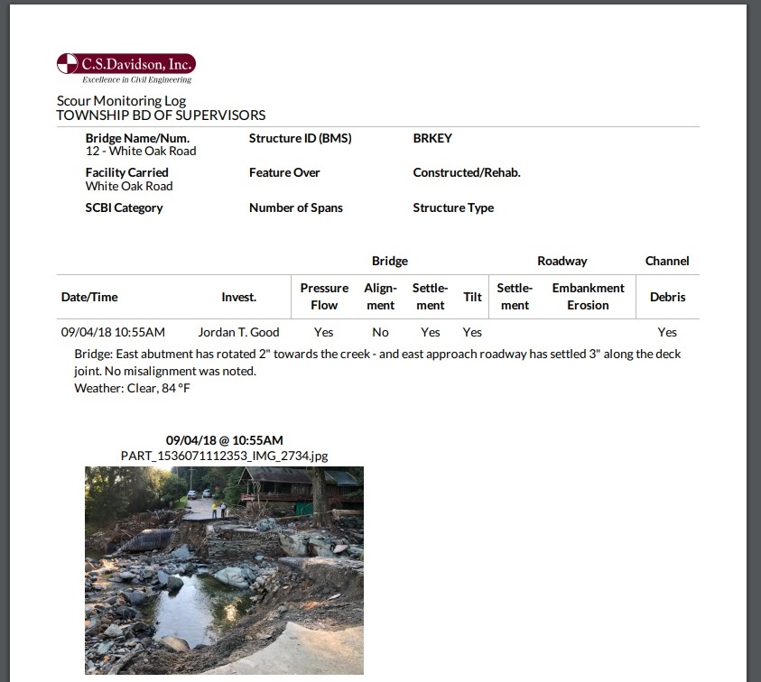
Toss in a few photos, hit save - and you've got a formatted PDF!
This tool was used during an FHWA audit a few years ago in York County and was extremely helpful to document the team's responsiveness. WE know that you're out there responding and inspecting in a crisis - but others might not. So just take the extra time to document your visit - and let CSDatum handle the rest.
As always - we're here to help with your infrastructure needs and answer any of your questions. Here's to a dry and cool Autumn!