
Hello all - and we hope you had a great Memorial Day weekend. Summer is just around the corner - and that means there's local college students out there looking for quality internships. Consider hiring one and setting them loose with some projects in CSDatum; we have many examples of geography majors from Millersville, Shippensburg, F&M, etc making a real impact in just a few short months.
Speaking of interns, our very own Kyle Jones (York College - Computer Science) has done a fantastic job with this new update. He hails from Stewartstown in York County and we're happy to have him aboard. He wrote all the code for this improvement and the following "tutorial" was also written by him.
Custom owner names with map filtering is finally here! This means that you can now assign a custom owner name to each of your assets. Just as important, you can now apply a map filter with these custom names across all layers and assets.
Instead of the default owner names (Municipal, State, Private & Joint), you may now enter your own name for any asset. A good example of this? Many of you have mapped or located inlets, streets, sewer pipes or manholes just outside your municipal boundary. You don't own them - but it's probably a good idea to know where they are. Before, you had to classify them as "Municipal", which lumped them into YOUR ownership category and forced you to leave a note to differentiate. This was also difficult for Sewer or Water Authorities that span many municipalities. No longer!
Changing the owner is the same as before, simply edit the ‘Owned By’ field in the general section of an asset’s data.
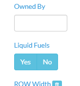
This field is considered a "type-ahead" which means that after you type "PennDOT" or your Municipality name once - it will be available as an option in every Asset afterwards. Take care to consistently and accurately use this list.
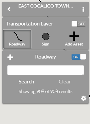
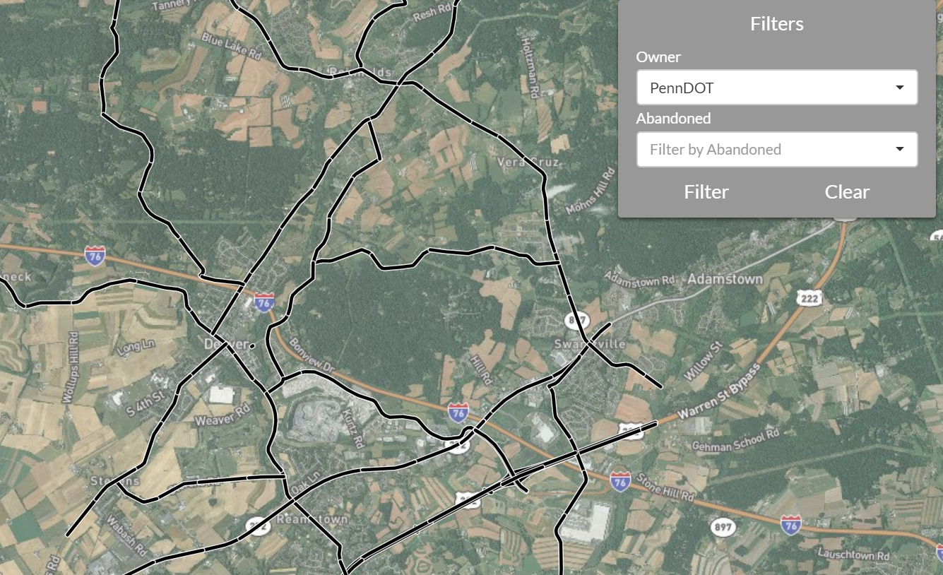
Our updated map filter (available by pressing the three vertical dots, then pressing the “Filter” button, as shown in the visual below) allows you to filter the features according to their owner name OR abandoned status.
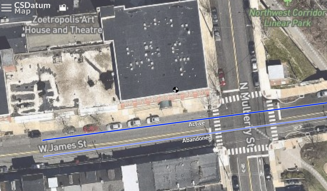
As you can see in the visual, the owner filter options are auto-populated with the names entered in your various assets. You may also filter by the abandoned status of those assets. If you haven't used the abandoned feature before - it allows you to preserve the data and location of your old infrastructure - but adjusts the color transparency of the line or point on your map.
Just select the filter options that you want to apply, click “Filter”, and you’ll immediately see the filter applied. A key note, this will filter every layer that you have turned on, so it's a great way to quickly view EVERYTHING that one or multiple owners are linked to.
We recognize many of you only have your local roads (or stormwater or sewer, whatever) added. If you have other mapping that you would like added to your account - please let us know!